Climate
The coastal areas of the Western Cape have a ‘Mediterranean’ climate associated with warm, dry summers and cold, damp winters. The winter months has the highest rainfall and little to no rainfall prevail in the summer months of Nov, Dec, Jan & Feb. Near the coast, summer temperatures near the at the coast typically range from 15º C to 30º C, whereas inland temperatures are usually about 4-5º C higher. Winters temperature averages range from 6º C to peaks of 22º C. The best time to visit is March / April when the summer’s heat subsides and the wind settles down.
Ocean Tides Explained
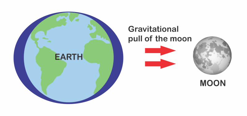
Tides are periodic rises and falls of large bodies of water. Tides are caused by the gravitational interaction between the Earth and the Moon. The gravitational attraction of the moon causes the oceans to bulge out in the direction of the moon. Another bulge occurs on the opposite side, since the Earth is also being pulled toward the moon (and away from the water on the far side). Since the earth is rotating while this is happening, two tides occur each day.
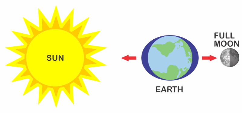
Spring tides are especially strong tides. They occur when the Earth, the Sun, and the Moon are in a line. The gravitational forces of the Moon and the Sun both contribute to the tides. Spring tides occur during the full moon and the new moon.
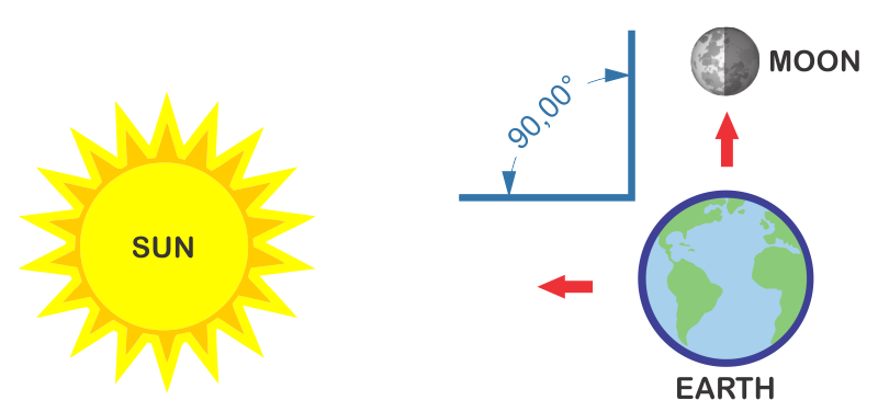
Neap tides are especially weak tides. They occur when the gravitational forces of the Moon and the Sun are perpendicular to one another (with respect to the Earth). Neap tides occur during quarter moons.
Useful Links:
Western Cape Wind Speed Map (Live)
Map indicating wind speeds and wind direction ideal for sailors, kite or wind surfers.
Hydrographic Charts (SA Navy)
Detailed charts indicating tides, sunrise, sunset, moon cycles etc.
Quick Tide Forecast (Western Cape)
Cape Town | Hermanus | Mossel Bay | Knysna